Over the years, I have been quite vocal about how our infrastructure is broken, to the point where we cannot even fulfill the most basic accessibility policies in our state. Sidewalks, bike lanes, multi-use-paths are all an ongoing joke in terms of their presence ( or maintenance ). The argument is almost always ‘no one uses them anyways’, usually followed by ‘you have to have a car here’.
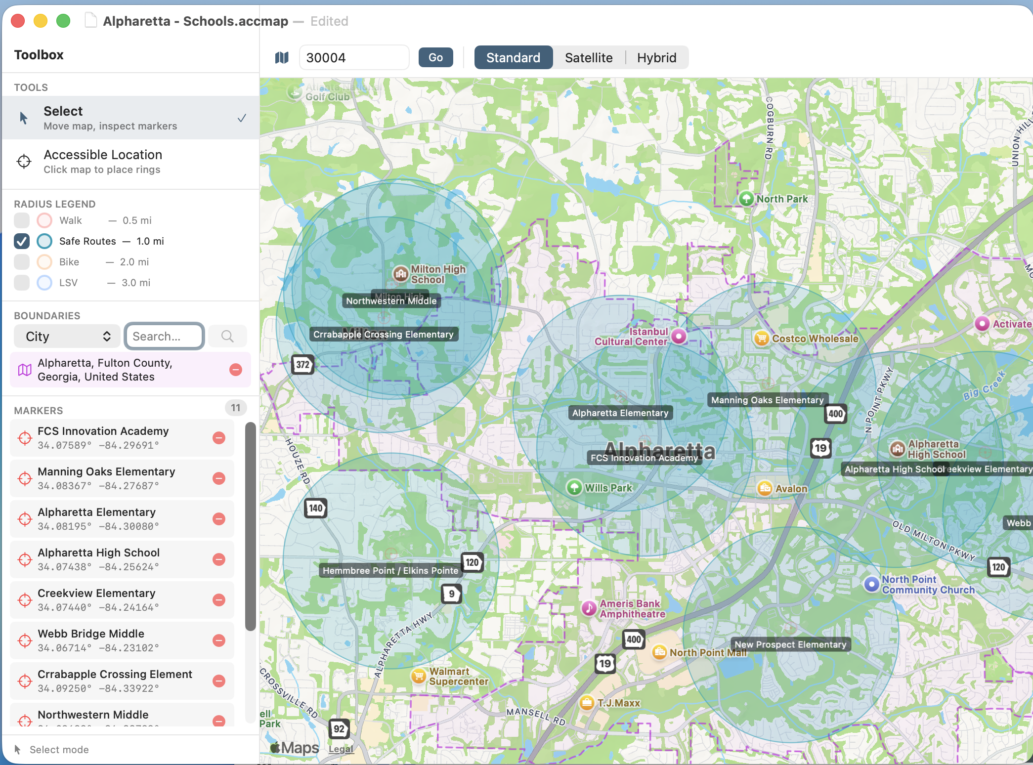
A few years back I did a couple of presentations to the local cities to demonstrate just how much of these cities should have sidewalks at a minimum just to cover the State’s ‘Safe Routes to School’ policy, much less supporting bicycles or even various Low Speed Vehicle options. They were lovely slideshow presentations, with a lot of details including a bunch of manually created maps showing the 1 mile radius of the Safe Routes to School areas that should be safely walkable. ( One of those presentations is [here] )
Those maps took hours to create, and were nigh impossible to keep updated.
Not too long ago I was asked to do a similar presentation for another area city. I was less than thrilled about the amount of work it would take. Well, now “There is an App for That”. Meet AccessibilityMapper. Created by Druware, published on the Apple App Store(s), it is a tool for rapidly generating, and easily maintaining accessibility maps for just these situations. Free for non-commercial use, this is a tool for planners, advocates, and even citizens that are curious about what these maps really look like.
Give it a look.
You can get more information about it, and download it for free from Druware Software Designs.